
Or pick a specific conversion (9)
CAD formats compared
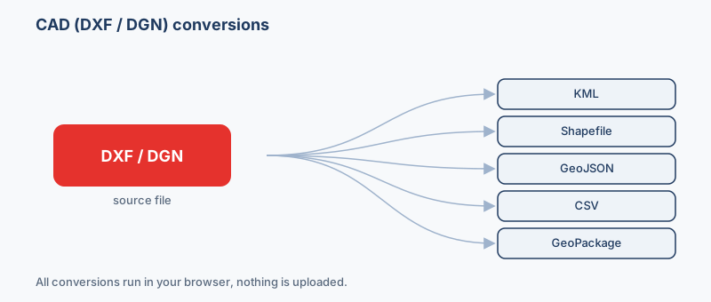
How the formats in this family differ, so you can pick the right target before converting.
| Format | What it is | Geometry | Styling | CRS | Opens in |
|---|---|---|---|---|---|
| DXF .dxf | DXF is Autodesk's open interchange format for CAD drawings and is supported by virtually… | CAD entities | Layers | None (assign) | AutoCAD, QGIS, MicroStation |
| DGN .dgn | DGN is Bentley MicroStation's CAD format, used heavily in civil engineering, transportat… | CAD entities | Layers | None (assign) | Bentley MicroStation, AutoCAD, QGIS |
| Shapefile .shp | The Shapefile is the long-standing Esri vector format and remains the lingua franca of d… | One type per file | No | Any (stored) | ArcGIS, QGIS, GeoServer |
| KML .kml | KML is the XML-based format Google Earth and Google Maps use to describe points, lines, … | Points, lines, polygons | Yes | WGS84 only | Google Earth, Google Maps, QGIS |
| GeoJSON .geojson | GeoJSON is an open, JSON-based standard (RFC 7946) for encoding vector features and thei… | Points, lines, polygons | No | WGS84 only | Leaflet, Mapbox GL, OpenLayers |
Which format should I use?
- You need to show engineering or survey geometry to a client on Google Earth → KML. Layers become folders and lines/polygons draw in Google Earth, but you must georeference the drawing first since KML is always WGS84.
- You want to analyze or edit the drawing in QGIS or ArcGIS → Shapefile. It is the universal GIS exchange format, though each geometry type (points, lines, polygons) has to be split into its own file.
- You have many CAD layers and long field names to keep in one tidy file → GeoPackage. A single SQLite database holds every layer with no 10-character field-name limit and no loose sidecar files.
- You are dropping the geometry into a Leaflet or Mapbox web map → GeoJSON. It is the native, human-readable web-map format and needs no styling or projection setup beyond WGS84.
- You just want a coordinate list or to check what layers exist → CSV. It flattens each feature to a row of coordinates and layer attributes you can open in any spreadsheet.
Popular cad conversions
Pick the conversion that matches where the drawing is headed. To share a site plan in Google Earth, convert DXF to KML after setting its coordinate system. To analyze it in QGIS or ArcGIS, convert DXF to a shapefile, or extract a plain coordinate and layer list with DXF to CSV. Going the other way, you can also turn KML back into DXF to hand mapped data to a CAD user.
Why CAD drawings usually have no coordinate system
DXF and DGN files store geometry in local or engineering coordinates: a site grid whose origin might be a survey benchmark or an arbitrary point, with no .prj and no embedded CRS. Converted as-is, features can land near (0,0) off the coast of Africa or nowhere near reality. To georeference, set the source coordinate system to the projected grid the surveyor actually used, often a UTM zone, a national grid, or a State Plane zone in meters or feet, and the engine will reproject to WGS84 for KML or GeoJSON. A truly arbitrary local grid instead needs control points to align it, which is beyond a straight format swap.
Layers become attributes (CAD has no attribute table)
CAD files carry no attribute table. The information lives in the drawing structure instead: the AutoCAD layer or DGN level name, color, linetype and any text or block labels. The GDAL driver exposes these as fields such as Layer, Linetype and Text, so mapping the layer name to a category column is how you turn "everything on the WATER layer" into a queryable class after conversion.
Drawing units: meters, feet or unitless
CAD coordinates are plain numbers with no guaranteed unit, a value of 100 could be 100 meters, 100 feet or 100 unitless drawing units. The $INSUNITS header may hint at it but is often unset. Because your chosen CRS implies a unit (UTM is meters; some State Plane zones are US survey feet), the CRS unit must match the drawing's real unit or the scale will be wrong.
DWG must be saved as DXF first
Native AutoCAD .dwg is a closed binary format this tool cannot read. Open it in AutoCAD, BricsCAD or a free viewer and export or save-as DXF (or DGN) first, DXF being the text interchange format designed for exactly this.
How it works
- Drop your DXF or DGN file above. It is read locally by a GDAL engine compiled to WebAssembly.
- Pick an output format (KML, KMZ, GeoJSON, Shapefile, CSV, Excel (XLSX)…) and, for vector output, a coordinate system if you need one.
- Click Convert and download. Nothing is uploaded, and it works offline once loaded.
MicroStation DGN: V7 only
The DGN reader handles V7 design files. For a V8 file from current MicroStation, use File > Save As and choose the V7 format, or export the drawing to DXF and convert that instead.
Frequently asked questions
Why does my converted CAD file appear in the wrong place, or not on the map at all?
Almost always a coordinate-system problem. The drawing was in local or engineering coordinates with no CRS, so the converter had nothing to reproject from. Set the source coordinate system (the UTM zone, national grid or State Plane zone the surveyor used) before converting, and the geometry will line up in WGS84 formats like KML and GeoJSON.
Can I convert a DWG file directly?
No. DWG is AutoCAD's closed binary format. Open it in AutoCAD, BricsCAD or a free DWG viewer and save or export it as DXF (or DGN) first, then convert that. DXF is the plain-text interchange format meant for moving drawings between programs.
What happens to my CAD layers when I convert?
CAD has no attribute table, so the layer or level name is preserved as a data field (usually called Layer) on each feature, alongside color, linetype and any text. After conversion you can filter or symbolise by that Layer field in your GIS, which is how you separate, say, roads from utilities.
How do I know what units my drawing is in?
Check the drawing's units setting in CAD, or the $INSUNITS value in the DXF header if it is set. It matters because the coordinate system you choose implies a unit: metric UTM and State Plane zones expect meters, while some US State Plane zones are in survey feet. Mismatched units make everything the wrong scale.
Will colors, line weights and text styling survive the conversion?
Not as visual styling. GIS vector formats like Shapefile, GeoJSON and GeoPackage store geometry and attributes, not CAD linework appearance. Layer and color information is carried across as data fields you can restyle in your GIS, but the exact CAD look is not reproduced. KML is the exception and can retain basic colors.
Which output format should I choose for a CAD drawing?
KML for viewing in Google Earth, Shapefile or GeoPackage for analysis in QGIS/ArcGIS (GeoPackage if you want all layers in one file with long field names), GeoJSON for web maps, and CSV if you only need a coordinate and attribute list. GPX suits loading points or paths onto a GPS device.
Is DGN (MicroStation) supported as well as DXF?
Yes. Both AutoCAD DXF and MicroStation DGN are read by the same GDAL engine. DGN organizes geometry by levels rather than layers, but the same rules apply: expect local coordinates you may need to georeference, no attribute table, and level names carried across as fields.
Is my drawing uploaded anywhere?
No. Everything runs in your browser using GDAL compiled to WebAssembly. Your DXF or DGN file is read and converted locally on your device and never leaves it, which also means it works offline once the page has loaded.