
Or pick a specific conversion (5)
GPX formats compared
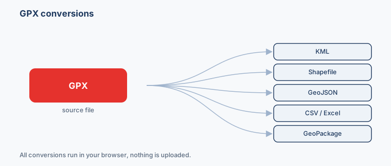
How the formats in this family differ, so you can pick the right target before converting.
| Format | What it is | Geometry | Styling | CRS | Opens in |
|---|---|---|---|---|---|
| GPX .gpx | GPX is the open XML standard that GPS devices and fitness apps use to record waypoints, … | Points & lines | No | WGS84 only | Garmin, Strava, Komoot |
| KML .kml | KML is the XML-based format Google Earth and Google Maps use to describe points, lines, … | Points, lines, polygons | Yes | WGS84 only | Google Earth, Google Maps, QGIS |
| Shapefile .shp | The Shapefile is the long-standing Esri vector format and remains the lingua franca of d… | One type per file | No | Any (stored) | ArcGIS, QGIS, GeoServer |
| GeoJSON .geojson | GeoJSON is an open, JSON-based standard (RFC 7946) for encoding vector features and thei… | Points, lines, polygons | No | WGS84 only | Leaflet, Mapbox GL, OpenLayers |
| CSV .csv | CSV is the universal spreadsheet exchange format: rows of plain-text values that open in… | Points (columns) + WKT | No | None (assign) | Excel, Google Sheets, QGIS |
Which format should I use?
- You want to see a hike or ride in Google Earth → KML or KMZ. Google Earth reads KML natively and drapes the track over 3D terrain, using the GPX elevation values for a profile.
- You need the data in desktop GIS like QGIS or ArcGIS Pro → Shapefile or GeoPackage. Both are first-class GIS formats; GeoPackage is one file with no field-name limits, while a shapefile splits points and tracks into separate geometry types.
- You're putting the route on a web map with Leaflet or Mapbox → GeoJSON. It is the RFC 7946 web-native format those libraries load directly, human-readable and already in WGS84.
- You just want to read the waypoint coordinates in a spreadsheet → CSV or Excel. Each point becomes a row with latitude and longitude columns you can sort, filter and paste elsewhere.
- You want to load the file back onto another GPS unit or app → GPX. Keeping it as GPX preserves the native waypoint/route/track structure that Garmin, Strava and Komoot expect.
Popular gpx conversions
Pick the destination that matches where the data is heading. To view a recorded ride or hike in Google Earth, convert GPX to KML; for desktop GIS work in QGIS or ArcGIS, turn GPX into a shapefile. Web-map builders will want to export GPX as GeoJSON, and if you only need to read the waypoint coordinates you can convert GPX to CSV and open it in any spreadsheet. Every conversion runs entirely in your browser.
Waypoints, routes and tracks are three different things
A GPX file can hold up to three kinds of feature, and it matters which one you have. A waypoint is a single marked point — a summit, a trailhead, a photo spot. A route is a planned, ordered list of points you intend to follow. A track is the breadcrumb log of where you actually went, a dense string of trackpoints usually stamped with time and elevation. When you convert, waypoints become point features and routes and tracks become lines, so a single GPX often yields more than one layer or geometry type in the output.
Where GPX files come from
GPX is the lingua franca of consumer GPS. Garmin handhelds and watches export it through Garmin Express and BaseCamp; Strava, Komoot and Ride with GPS all offer GPX download; and phone apps like OsmAnd, Gaia GPS and AllTrails record straight to it. Because the schema is standard, files from any of these sources convert the same way here.
A fixed schema and limited attributes
Unlike a shapefile or GeoPackage, GPX has a fixed schema. Each point carries a small, predefined set of fields — name, description, elevation, time, symbol — and little else. There is no free-form attribute table, so if your workflow depends on rich attributes, expect the extras to be thin coming out of GPX. Going the other way, converting GPX to CSV or GeoJSON is the cleanest way to expose those built-in fields as columns you can work with.
WGS84 only, and no polygons
Every GPX coordinate is WGS84 longitude/latitude (EPSG:4326) by definition — there is no projection to guess or reproject on the way in. The format also has no concept of an area: it stores points and lines only, never polygons. A closed loop stays a line whose start and end happen to touch, so you cannot represent a filled region such as a park boundary or zone directly in GPX.
How it works
- Drop your GPX file above. It is read locally by a GDAL engine compiled to WebAssembly.
- Pick an output format (KML, KMZ, Shapefile, GeoJSON, CSV, Excel (XLSX)…) and, for vector output, a coordinate system if you need one.
- Click Convert and download. Nothing is uploaded, and it works offline once loaded.
Frequently asked questions
What is a GPX file?
GPX (GPS Exchange Format) is an open XML standard for GPS data. A file can hold waypoints (single marked points), routes (a planned sequence of points), and tracks (a recorded breadcrumb trail of where you actually went). Nearly every GPS device and fitness app can read or write it.
Will my Strava, Komoot or Garmin export work?
Yes. GPX is the common export format for Strava activities, Komoot routes and Garmin devices, and this converter reads all of them. Drop the .gpx file and convert it to KML, Shapefile, GeoJSON, CSV, Excel or GeoPackage right in your browser.
What's the difference between a route and a track in my file?
A route is a planned, ordered set of points you intend to follow, usually sparse. A track is the actual recorded path, a dense list of trackpoints often stamped with time and elevation. Tracks come from recording an activity; routes are typically created in planning software beforehand.
Are my files uploaded anywhere?
No. The conversion runs entirely in your browser using GDAL compiled to WebAssembly. Your GPX file is read on your own device and never sent to a server, and the tool keeps working offline once it has loaded.
Why did some of my attribute columns disappear when I converted from GPX?
GPX only stores a fixed set of fields — name, description, elevation, time and symbol. It has no free-form attribute table, so there is little extra data to carry across. If you need rich attributes, the limitation is in the source GPX, not the conversion.
What coordinate system does GPX use?
GPX is always WGS84 longitude/latitude (EPSG:4326) by definition, so there is nothing to set on input. When you convert to a format that supports other coordinate systems, such as Shapefile or GeoPackage, you can reproject to another EPSG code if your workflow needs it.
Can I convert GPX to a polygon or area shape?
Not directly. GPX stores only points and lines, with no concept of a filled area, so a closed track stays a line rather than becoming a polygon. You would convert to a format like Shapefile or GeoJSON and then rebuild the geometry as a polygon in GIS software afterwards.
Can I turn a spreadsheet of coordinates into GPX?
Yes, in the other direction. If you have a CSV or Excel sheet with latitude and longitude columns, our CSV-to-GPX and Excel-to-GPX tools create waypoints from each row so you can load them onto a GPS device.