
Or pick a specific conversion (12)
Shapefile formats compared
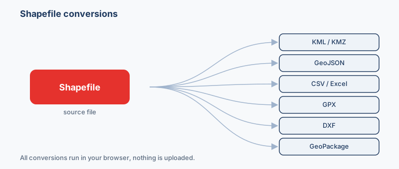
How the formats in this family differ, so you can pick the right target before converting.
| Format | What it is | Geometry | Styling | CRS | Opens in |
|---|---|---|---|---|---|
| Shapefile .shp | The Shapefile is the long-standing Esri vector format and remains the lingua franca of d… | One type per file | No | Any (stored) | ArcGIS, QGIS, GeoServer |
| GeoJSON .geojson | GeoJSON is an open, JSON-based standard (RFC 7946) for encoding vector features and thei… | Points, lines, polygons | No | WGS84 only | Leaflet, Mapbox GL, OpenLayers |
| GeoPackage .gpkg | GeoPackage is an open OGC standard that stores vector features (and optionally raster ti… | Points, lines, polygons | No | Any (stored) | QGIS, ArcGIS Pro, GDAL |
| KML .kml | KML is the XML-based format Google Earth and Google Maps use to describe points, lines, … | Points, lines, polygons | Yes | WGS84 only | Google Earth, Google Maps, QGIS |
| CSV .csv | CSV is the universal spreadsheet exchange format: rows of plain-text values that open in… | Points (columns) + WKT | No | None (assign) | Excel, Google Sheets, QGIS |
| GML .gml | GML is the OGC's XML grammar for geographic features and is widely used in European INSP… | Points, lines, polygons | No | Any (stored) | QGIS, GeoServer, deegree |
Which format should I use?
- You need to open Esri data in Google Earth or send it to a non-GIS colleague → KML or KMZ. Both render instantly in Google Earth and carry your labels, and KMZ zips the styling into a single file to email.
- You are building a Leaflet, Mapbox or OpenLayers web map → GeoJSON. It is the RFC 7946 web-native format every JavaScript mapping library reads directly, with no multi-file baggage.
- You want the attribute table in a spreadsheet or need long, unabbreviated field names → CSV or GeoPackage. CSV drops geometry into plain columns for Excel, while GeoPackage keeps geometry plus field names far longer than the shapefile 10-character cap.
- You are handing geometry to a CAD drafter in AutoCAD or MicroStation → DXF. It maps shapefile features onto CAD layers, though the attribute table and .prj coordinate system do not come along.
- You want one portable file with multiple layers and no sidecar files to lose → GeoPackage. A single .gpkg SQLite database replaces the four-to-five-file shapefile bundle and has none of its legacy limits.
Popular shapefile conversions
Pick the exact conversion you need. To view Esri data in Google Earth, convert your shapefile to KML; to drive a Leaflet or Mapbox web map, turn a shapefile into GeoJSON. When you only want the attribute table, export the shapefile to CSV for Excel, and to hand clean geometry to a drafter you can convert a shapefile to DXF for AutoCAD. Every conversion runs in your browser, and your files are never uploaded.
A shapefile is not one file
The name is misleading: a working shapefile is a bundle. The .shp holds the geometry, the .shx is its position index, and the .dbf stores the attribute table. Two sidecars matter just as much, the .prj (coordinate system) and the optional .cpg (text encoding). All of them share a base name and must travel together, which is why you upload and download a shapefile as a single .zip. Drop only the .shp and the converter has geometry with no attributes and no CRS.
The .prj file and misplaced data
The .prj records the coordinate reference system in WKT. Without it the numbers in the .shp are just unlabelled X/Y values, so a tool guesses, and a UTM or State Plane dataset read as if it were WGS84 produces out-of-range, nonsensical positions (projected meters cannot be read as degrees). Keep the .prj in the zip and every output inherits the correct CRS; you can also override it to EPSG:4326 or EPSG:3857 during conversion.
The 10-character field-name trap
The .dbf format caps column names at 10 characters, so "population_density" is silently truncated to "population" and duplicates get mangled to POPULAT_1. Names longer than 10 characters were destroyed when the data first became a shapefile, so converting out cannot recover them. Formats like GeoJSON, GeoPackage and CSV have no such limit.
One geometry type, and the modern successor
A single shapefile holds only points, only lines, or only polygons, never a mix, and stores no styling. GeoPackage (.gpkg), an OGC SQLite database, is the modern replacement: one file, many layers, long field names, and none of these constraints.
How it works
- Drop your ZIP file above. It is read locally by a GDAL engine compiled to WebAssembly.
- Pick an output format (KML, KMZ, GeoJSON, CSV, Excel (XLSX), GPX…) and, for vector output, a coordinate system if you need one.
- Click Convert and download. Nothing is uploaded, and it works offline once loaded.
First, zip the parts together
| File | What it holds | If it is missing |
|---|---|---|
| .shp | The geometry | Nothing to convert |
| .shx | The index that links shapes to rows | The file may not open |
| .dbf | The attribute table | You get shapes with no data |
| .prj | The coordinate system | The layer can land in the wrong place |
Select the parts themselves, zip them, and drop the .zip. Add the .cpg too if your attribute text uses non-English characters. Output shapefiles come back the same way, zipped and complete.
Frequently asked questions
Do I have to zip my shapefile before converting?
Yes. A shapefile is really several files that share a base name, at minimum .shp, .shx and .dbf, plus the .prj for the coordinate system. Put them all in one .zip and upload that. If you send only the .shp, the converter has geometry but no attribute table and no CRS.
Which files must be inside the zip?
Always include .shp (geometry), .shx (index) and .dbf (attributes). Add the .prj so the coordinate system is known, and the .cpg if your text uses non-English characters. Missing the .shx or .dbf will usually cause the read to fail; missing the .prj lets the data convert but risks it landing in the wrong place.
Why did my field names get shortened after conversion?
Shapefiles store attributes in a dBASE (.dbf) table whose column names are limited to 10 characters. A name like "average_temperature" was truncated to "average_te" when the data became a shapefile. Converting to GeoJSON, CSV or GeoPackage keeps whatever name currently exists but cannot restore characters that were already lost.
My converted points show up in the wrong location. What happened?
Almost always a coordinate-system problem. If the .prj was missing, the tool assumed WGS84 while your data was actually in UTM, State Plane or another projected system, so the coordinates were interpreted as degrees. Re-run the conversion with the .prj included, or set the correct source CRS (for example the UTM zone or State Plane EPSG code the data was created in, not EPSG:4326).
Can one shapefile hold points, lines and polygons together?
No. Each shapefile stores exactly one geometry type. If your data mixes types you will have separate shapefiles, and you convert each one individually. GeoPackage and GeoJSON holds multiple geometry types in one FeatureCollection, and GeoPackage holds multiple layers in a single file.
Will my map styling (colors and symbols) survive the conversion?
No. The shapefile format stores no styling at all, only geometry and attributes, so there is nothing to carry over. If you need colors and icons in the output, choose KML or KMZ and apply styling there; the geometry and attribute values always convert faithfully.
Is GeoPackage better than shapefile?
For most modern uses, yes. A GeoPackage is a single SQLite file that holds many layers, allows long field names, has no 2 GB size ceiling and needs no sidecar files. Shapefile remains useful mainly because older software and data-exchange requirements still expect it.
Are my files uploaded to a server?
No. The conversion runs entirely in your browser using GDAL compiled to WebAssembly. Your shapefile is read on your own device and never leaves it, which is why the tool keeps working even after you go offline.