
Why your GIS data shows in the wrong place (and how to fix it)
You loaded a layer and it sits in another country, or out at sea. Your data is almost certainly fine. When GIS data lands in the wrong place, the numbers are right but nothing tells the software what they mean. It guesses, and it guesses wrong. Three problems cause almost every case, and each is a two-minute fix.
Key facts
- Three causes account for almost every misplaced layer: a missing .prj, projected meters read as degrees, or swapped latitude and longitude.
- Latitude runs -90 to 90 and longitude -180 to 180, so any value above 90 must be a longitude, a fast sanity check.
- A missing .prj strips a shapefile's coordinate system, which is the single most common trigger.
Find your cause
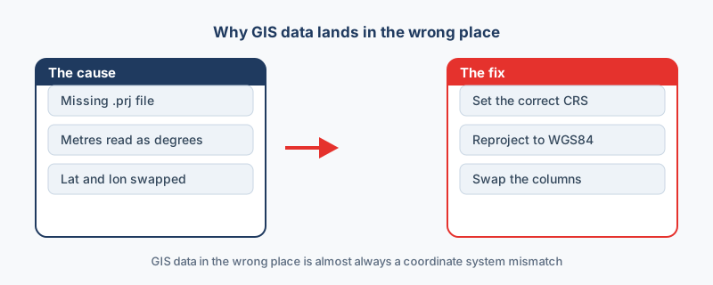
Match what you see against the symptoms below, and the fix follows directly.
| Symptom | Cause | Fix |
|---|---|---|
| Layer properties say the coordinate system is unknown | Missing .prj file | Add the .prj, or set the system by hand |
| Coordinates look like 451234 and 5411932 | Meters read as degrees | Declare the real system, then reproject |
| Points in the wrong hemisphere | Latitude and longitude swapped | Swap the two columns |
| Points off the coast of West Africa | Coordinates of 0, 0 | Find the rows with empty coordinates |
The 0, 0 pattern is the odd one out: those points sit at Null Island because their coordinate fields were empty, which is a data gap rather than a coordinate system problem. The three causes below cover everything else.
Cause 1: a missing .prj file
A shapefile keeps its coordinate system in the .prj, and that is the part people forget to send. Without it, the software cannot tell degrees from meters, so the layer floats off to the wrong spot. Open the layer properties and look at the coordinate system entry; if it reads unknown, the .prj is gone. Define the system before you reproject anything, because reprojecting from a wrong guess bakes the error in.
Cause 2: meters treated as degrees
Projected systems such as UTM measure position in meters, so a point might read 451234 and 5411932. A value of 451234 is an absurd longitude, and software that expects degrees sends the point flying far away. Tell the software which system the numbers belong to, for example EPSG:32631 for UTM zone 31N. Once the real system is declared, reproject to WGS84 if the data is headed for a web map or Google Earth.
Cause 3: latitude and longitude swapped
This one is common with spreadsheets, where longitude ends up in the latitude column and the points land in the wrong hemisphere. The range test catches it: any value above 90 has to be a longitude, because latitude cannot exceed 90. In the spreadsheet tool, the live map shows a swap before you export anything.
The recovery checklist
Run through these four checks, and data in the wrong place snaps back to where it belongs.
- The coordinate system is set, and it is the right one, not a guess.
- The data is reprojected to WGS84 if a web map or Google Earth needs it.
- Latitude and longitude sit in the correct columns, with no value above 90 posing as a latitude.
- No rows carry 0, 0 coordinates, and any code you need can be looked up at epsg.io.
“Nine times out of ten, “my data is in the wrong place” is a missing .prj or two swapped columns, not the conversion. Fix the coordinate system, not the tool.”
Frequently asked questions
How do I know which coordinate system my data uses?
Check the source or the metadata. Web data is usually WGS84, while survey and engineering data is often a UTM zone or a national grid. Look up any code at epsg.io.
Did the conversion move my data?
Almost never. A converter carries the numbers through unchanged, so a layer that lands wrong was mislabeled before it arrived. Fix the coordinate system, not the tool.
Is precision ever the problem?
No. In the site's benchmark, coordinates with seven decimal places survived every format, so rounding never moves a point visibly.
What is a .prj file and why does it matter?
The .prj records a shapefile's coordinate system. Without it, software cannot tell whether the numbers are degrees or meters, so the layer often lands far from home. Always send it with the other parts.
Why does my data appear off the coast of Africa?
Coordinates of 0,0 place a point at Null Island, off West Africa. It means the latitude and longitude fields were empty or unparsed, usually after a spreadsheet import in which the coordinate columns were not recognized.