
Coordinate systems, EPSG and WGS84, without the jargon
A coordinate is a pair of numbers, and on its own the pair means nothing. Coordinate systems give those numbers meaning: they tell software where a point sits on Earth. This guide explains that idea, along with EPSG codes and WGS84, in plain English.
Key facts
- WGS84 is EPSG:4326 (lon/lat degrees); Web Mercator is EPSG:3857 (meters); UTM has 60 zones, each 6° of longitude wide.
- Precision by decimal place: 5 places ≈ 1.1 m, 6 places ≈ 11 cm of latitude.
- KML, GPX and GeoJSON are all defined in WGS84, so no projection guesswork is needed on the way in.
Two families of coordinate systems
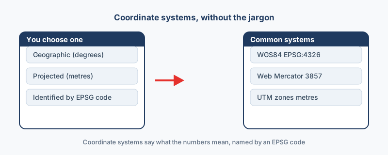
Every system belongs to one of two families, and the split is simple: one family measures angles on the globe, the other measures distance on a flat map. Both describe the same planet, and the same point can be written in either family, which is exactly what reprojection does: it rewrites coordinates from one system into another.
| Family | Units | Best for | Examples |
|---|---|---|---|
| Geographic | Degrees of latitude and longitude | Global data, GPS, data exchange | WGS84 |
| Projected | Meters on a flat map | Local measurement and web maps | UTM, Web Mercator |
WGS84, the world default
WGS84 is the system GPS and web maps use, which is why most latitude and longitude data you meet is already in it. Its EPSG code is 4326, a number you will see everywhere. KML, GPX and GeoJSON are all defined in WGS84, so there is no guesswork when you open those files. Degrees suit global data but feel awkward for local measurement, which is why surveyors switch to meters and projected systems.
EPSG codes: a number for every system
Every coordinate system has a number, its EPSG code, so instead of writing out a long definition you type the code. The registry was originally kept by the European Petroleum Survey Group, which is where the letters come from.
| Code | System | Units | Where you meet it |
|---|---|---|---|
| EPSG:4326 | WGS84 | Degrees | GPS, KML, GPX, GeoJSON |
| EPSG:3857 | Web Mercator | Meters | The drawing system of most web maps |
| EPSG:326xx and 327xx | UTM north and south | Meters | Surveying, in 60 zones of 6 degrees each |
Look up any code you do not recognize at epsg.io, which holds the full registry of every published system.
Why it matters to you
A mismatch puts data in the wrong place, and the failure is rarely subtle: meters read as degrees send a point thousands of kilometers away. Two habits prevent it: know which system your data is in, and reproject whenever a tool expects a different one.
Reproject in your browser
None of this needs heavy software, because the browser can do the work. The coordinate converter shows WGS84, UTM and Web Mercator at once for any point you paste in, and tools such as CSV to KML let you set the system before export. A coordinate system is just a label that keeps your data honest.
“Quote the EPSG code, not the name. “WGS84” is ambiguous in conversation; EPSG:4326 is not, and it is what every tool actually matches on.”
Frequently asked questions
How precise is a decimal degree?
Five decimal places is about 1.1 m of latitude, and six decimal places is about 11 cm. Consumer GPS receivers measure to a few meters, so five places already exceeds what most devices can deliver.
Which system does a web map want?
Usually WGS84 (EPSG:4326) for the data you load. The map itself draws in Web Mercator (EPSG:3857) and reprojects your data on the fly.
My data is already in the wrong place. What now?
Identify the system the data is really in, then reproject it to the one your tool expects. The guide on why GIS data shows in the wrong place walks through the diagnosis step by step.
What is an EPSG code?
An EPSG code is a short number that names a coordinate system, so you do not have to write its full definition. 4326 is WGS84, for example, and 3857 is Web Mercator. You can look codes up at epsg.io.
What is the difference between geographic and projected systems?
Geographic systems measure angles in degrees and suit global data. Projected systems, like UTM or Web Mercator, measure distance in meters and suit local measurement and web mapping.