
Latitude & longitude formats explained: DD, DMS and DDM
48.8584. 48°51'30"N. 48°51.5'N. Those are three different-looking numbers for exactly one place. Latitude and longitude formats cause real confusion for that very reason. This guide explains the three you will meet and shows how to read and convert each one.
Key facts
- Decimal degrees (48.8584), DMS (48°51'30"N) and DDM (48°51.5'N) all describe the same point.
- Precision: 5 decimal degrees ≈ 1.1 m; degrees-decimal-minutes to 3 places ≈ 1.8 m.
- Marine and aviation GPS default to DDM; GIS software and GeoJSON expect decimal degrees.
The three formats at a glance
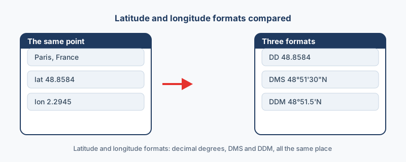
| Format | Example | Used by |
|---|---|---|
| Decimal degrees (DD) | 48.8584 | GIS software, GeoJSON, web maps, spreadsheets |
| Degrees, minutes, seconds (DMS) | 48°51'30"N | Paper maps, deeds, surveys |
| Degrees and decimal minutes (DDM) | 48°51.5'N | Marine and aviation GPS |
Each notation grew up around a different tool, which is why all three are still in daily use.
Decimal degrees: one number per axis
The whole number is the degrees, the decimal is the fraction of a degree, and a minus sign means south or west. More decimals mean more precision: five of them place a point within about one meter, which is why software, spreadsheets and web maps prefer this format. It is also the only one of the three that sorts and stores cleanly, since each axis is a single plain number.
DMS: three parts and a letter
In 48°51'30"N, the 48 is degrees, the 51 is minutes, the 30 is seconds, and the N names the hemisphere. A minute is a sixtieth of a degree and a second is a sixtieth of a minute, which is all the system is. Converting to decimal degrees takes one line of arithmetic: degrees, plus minutes divided by 60, plus seconds divided by 3600, made negative for south or west. Worked through, 48°51'30"N comes to 48.85833.
DDM: whole degrees, decimal minutes
In 48°51.5'N, the 51.5 is minutes and a fraction of a minute, and there are no seconds at all. Marine chartplotters and aviation units default to this notation, so a position read over a radio is usually DDM. Reaching decimal degrees is even shorter: divide the minutes by 60 and add them to the degrees. The value 48°51.5' comes to 48.85833 once rounded, the same point as the DMS version above.
Read the format before you read the number
The digits after the degree symbol mean different things in each notation. In DMS they are whole minutes with seconds still to come, while in DDM they are minutes and a fraction. Mistaking one for the other moves the point: read 48°51.30' as 51 minutes and 30 seconds, and the position shifts by roughly 370 meters. The two can look nearly identical on a cramped GPS screen, so identify the notation before you type anything in.
Convert without doing the math
The coordinate converter accepts a value in any of the three notations. Type one in and read DD, DMS, DDM, UTM and Web Mercator at once, free and in your browser. A whole sheet of coordinates converts the same way through the bulk option, and CSV to KML then puts the result on a map.
“The three notations trip people up because the digits after the degree symbol mean different things: whole minutes in DMS, minutes-and-a-fraction in DDM. Read the format before you read the number.”
Frequently asked questions
Which format should I use?
Decimal degrees, when in doubt. It is the safest choice for software, spreadsheets and web maps, and every GIS tool reads it.
Which is latitude and which is longitude?
Latitude runs from -90 to 90 and marks north or south. Longitude runs from -180 to 180 and marks east or west. Any value above 90 must be a longitude.
Can I convert a whole sheet?
Yes. Use the bulk option in the coordinate converter, then map the result with CSV to KML for Google Earth.
How do I convert DMS to decimal degrees?
Take the degrees, add the minutes divided by 60, then add the seconds divided by 3600, and make the result negative for south or west. Worked through, 48°51'30"N is 48 + 51/60 + 30/3600, which is 48.85833.