
GPX file explained: waypoints, routes and tracks
If you hike, cycle or survey, you will meet a GPX file sooner or later, because GPX is the common language of GPS devices. This guide explains what the file holds, the difference between its three kinds of content, and how to open and convert it.
Key facts
- GPX 1.1 stores waypoints, routes and tracks in WGS84 only, and has no polygon type.
- Its schema is fixed (name, description, elevation, time), so a 6-column dataset kept just 1 field when written to GPX in testing.
- Practically every GPS device and app reads it, including Garmin, Strava and Komoot.
What a GPX file is
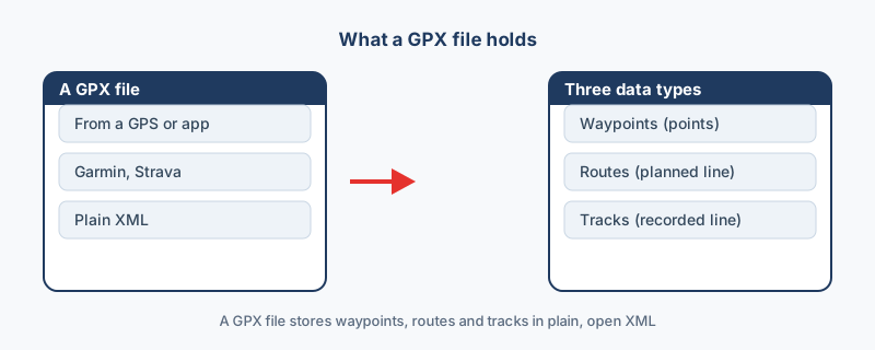
GPX stands for GPS Exchange Format, and it is an open, plain-text XML file. Because the format is open, almost every GPS device and app can read it, including Garmin units, Strava and Komoot, which is what makes it the usual way to move outdoor data between tools. You typically end up with one after a hike, a ride or a survey, and from there you can share it or put it on a map.
The three things inside
One file can hold three kinds of content, and each one means something different, so it pays to tell them apart before converting.
| Content | What it is | What it means |
|---|---|---|
| Waypoint | A single named point: a trailhead, a summit, a parking spot | A saved marker |
| Route | A planned path made of a few chosen points | Where you intend to go |
| Track | A recorded path, a dense line of timestamped points | Where you went |
Navigation units follow a route turn by turn, while fitness apps save your run as a track.
What GPX cannot do
The format stores points and lines only, so there are no polygons. Attributes are nearly as constrained, because the schema is fixed: in the site's benchmark, a six-column dataset kept one field when written to GPX. Treat it as a navigation format, and do not use it to carry an attribute table.
How to open a GPX file
For a quick look, drop the file into Google Earth or any mapping app, and for analysis load it into QGIS. GPX is always WGS84 longitude and latitude, so it lines up with Google Earth and web maps with no reprojection.
How to convert it
Use GPX to KML for Google Earth, GPX to Shapefile for GIS, or GPX to CSV for a spreadsheet; each one runs in your browser with nothing uploaded. After converting, confirm that waypoints, routes and tracks all survived the trip. The format details are documented at the GPX schema site, and once you know what the file holds, it is easy to use anywhere.
“GPX is a navigation format, not a data format. It moves where you went between devices beautifully, but do not expect your attribute table to survive the trip.”
Frequently asked questions
Can I make a GPX file from my own data?
Yes. Use KML to GPX or CSV to GPX in your browser. Keep in mind that GPX stores points and lines only, so polygons cannot make the trip.
Where is the GPX format documented?
At the GPX schema site, topografix.com/gpx.asp, which defines the waypoint, route and track elements along with the fixed set of attributes each one can carry.
Is my track uploaded when I convert it?
No. The file is read in your browser and converted on your own machine, so a private running route or survey track never reaches a server.
What is the difference between a route and a track in a GPX file?
A route is a planned path made of a few chosen points, so it is where you intend to go. A track is a recorded path made of many timestamped points, so it is where you actually went.
What coordinate system does a GPX file use?
GPX always uses WGS84 longitude and latitude. That matches Google Earth, GeoJSON and web maps directly, so no reprojection is needed for those formats.